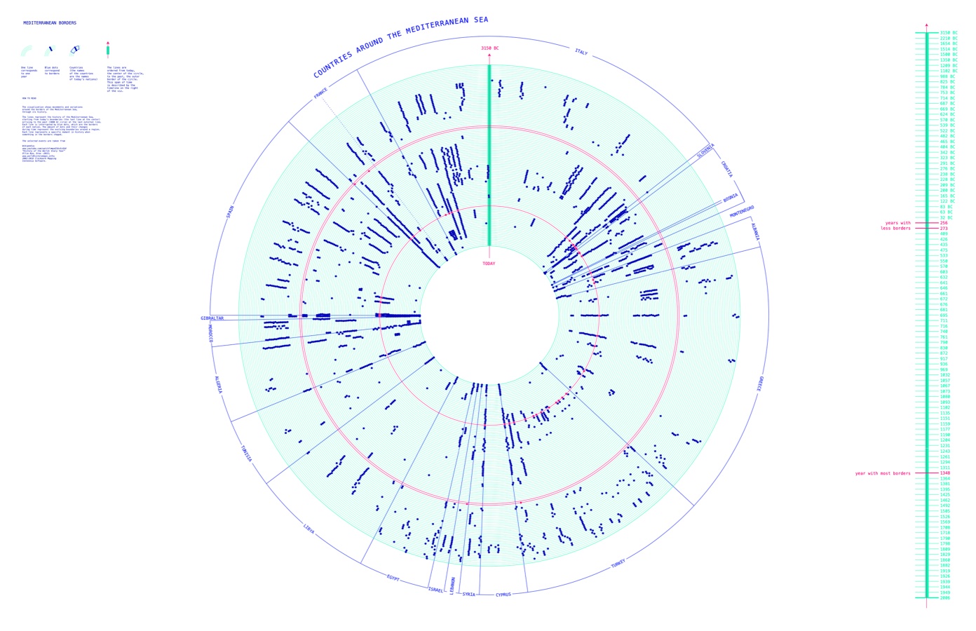
Mediterranean borders
Experiment visualizing the evolution of national borders on the Mediterranean coastline over 5000 years
Visualization experiment representing the evolution of national borders on the Mediterranean coastline, in collaboration with Federica Bardelli. Coasts become lines, borders become points, about 5000 years in one image.
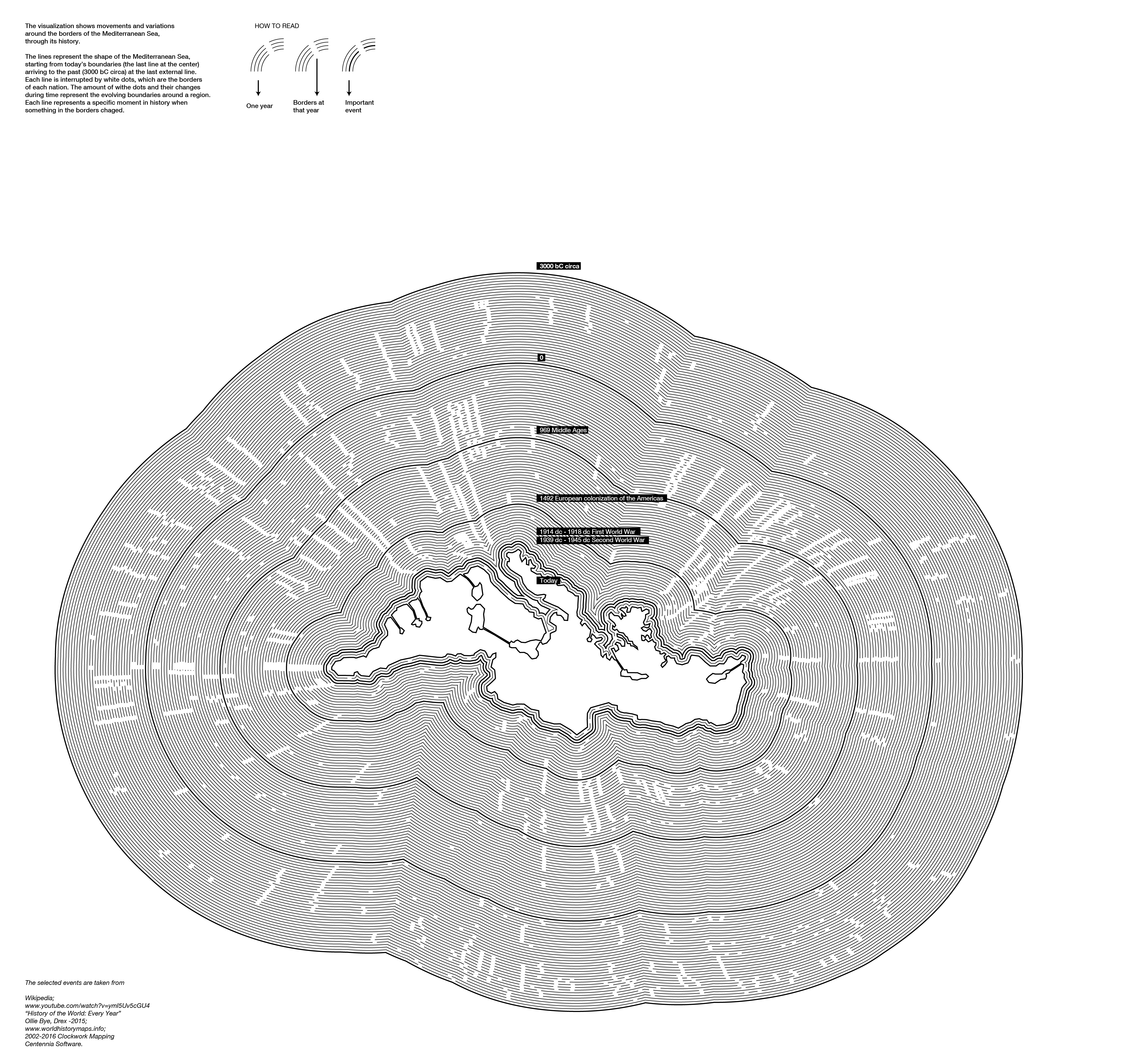
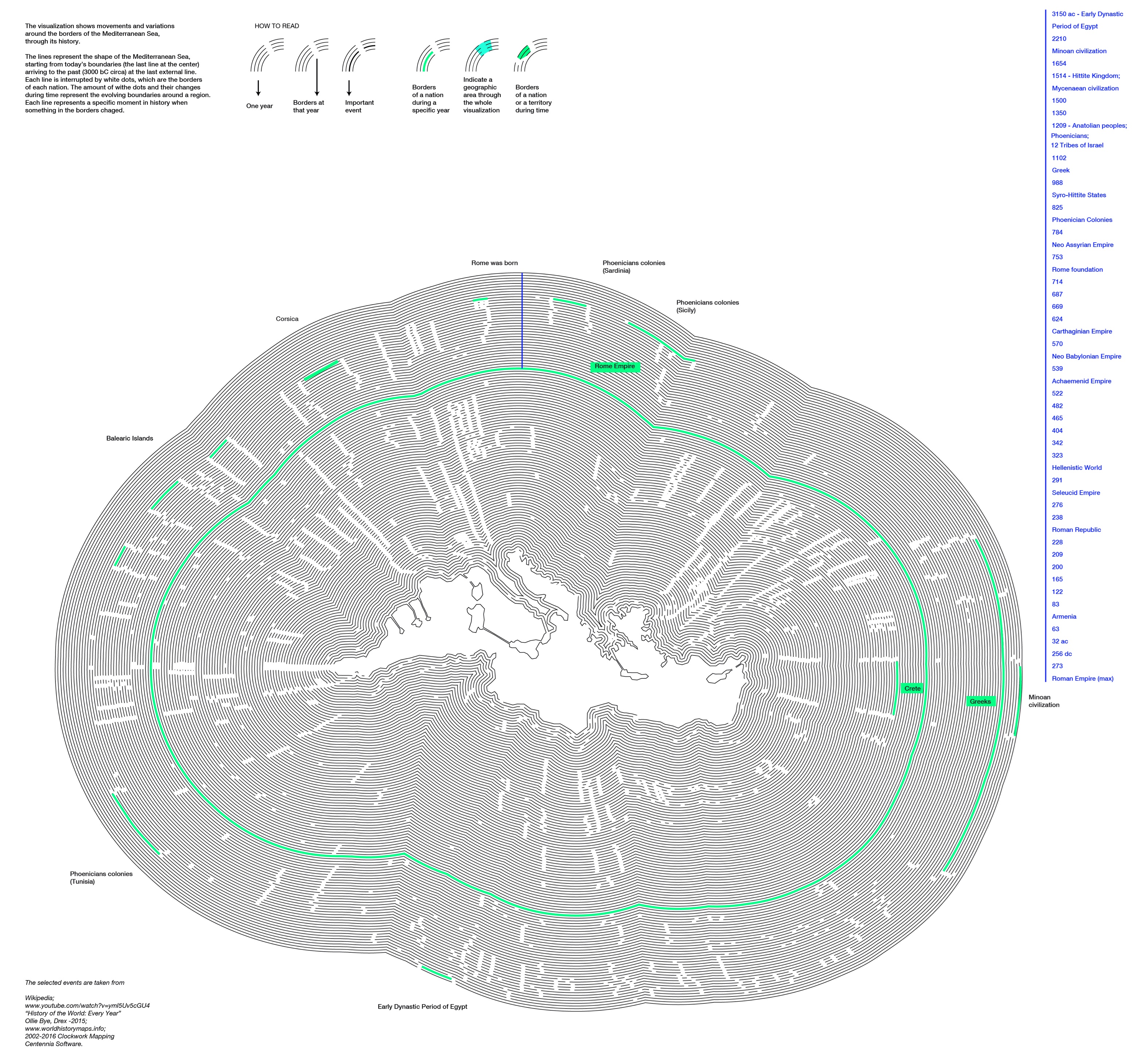
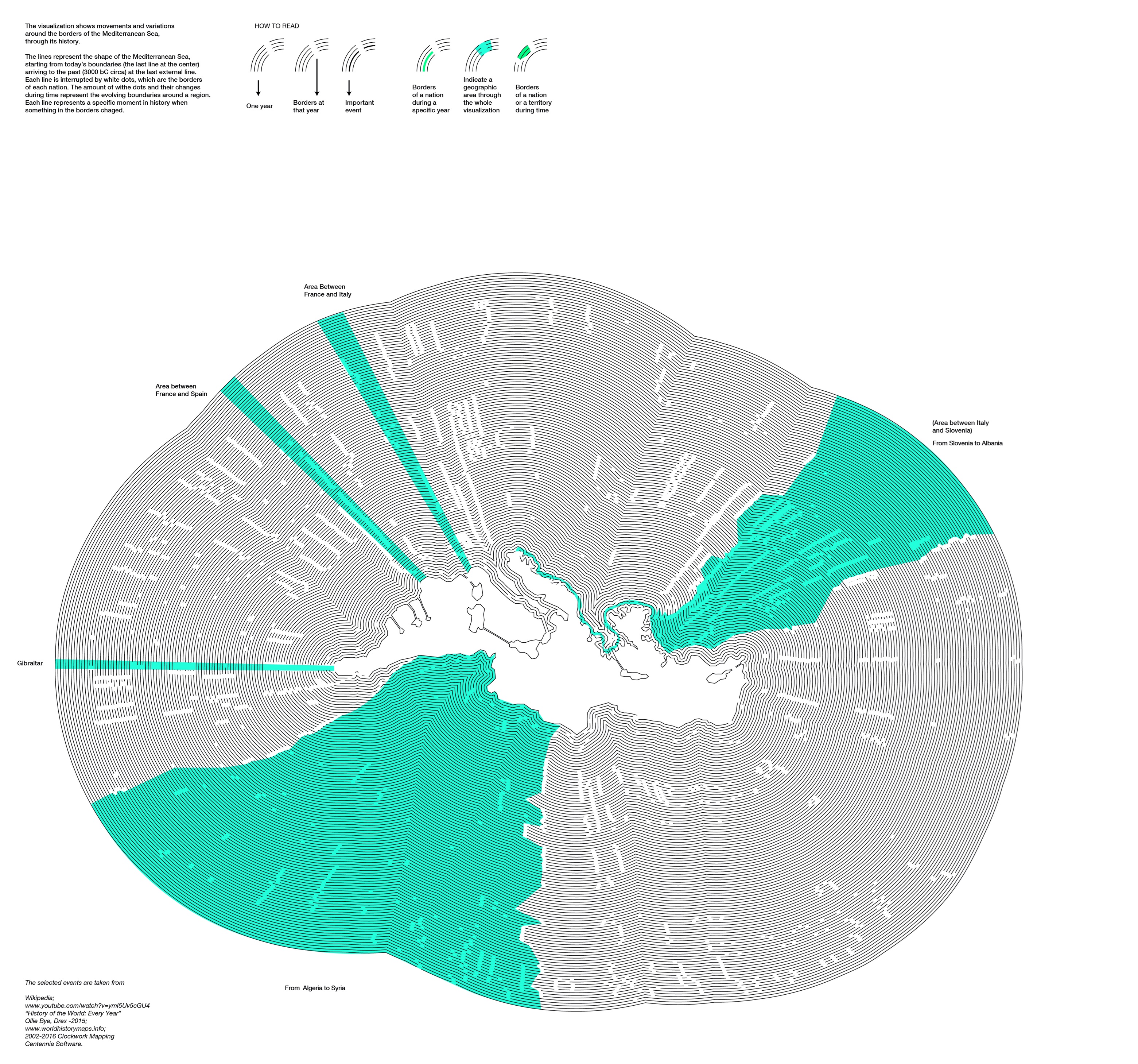
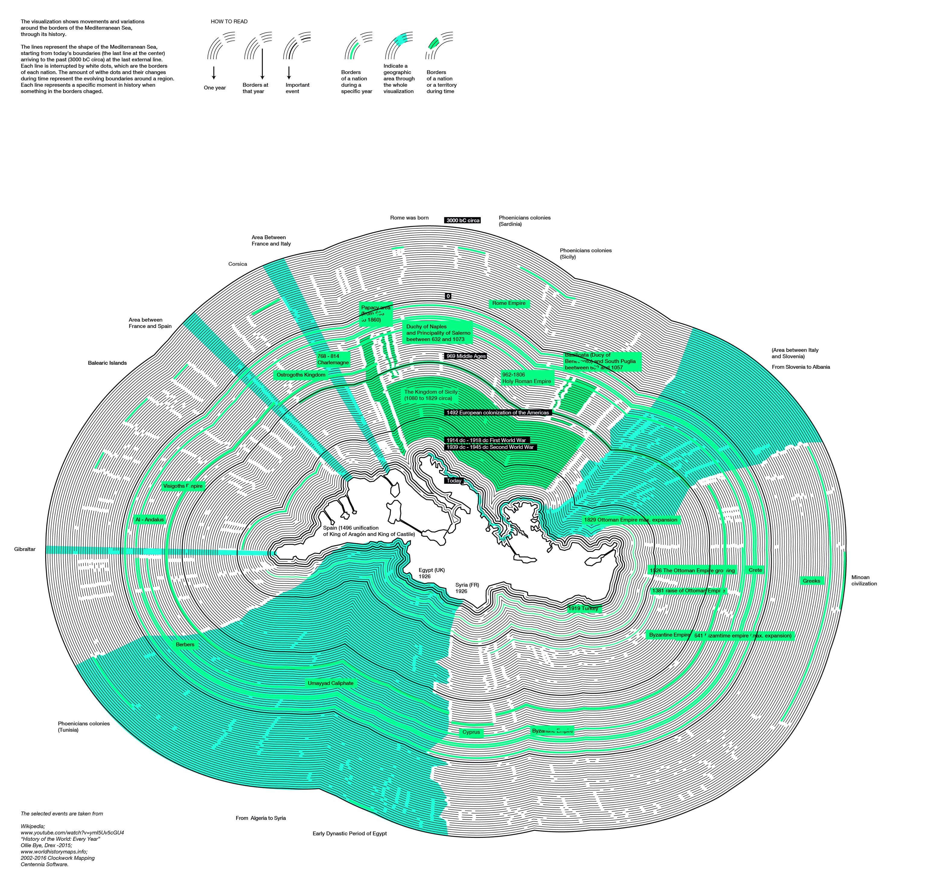
Disclaimer: the aim of this visualization is to experiment the combination of dense datasets of historical events and geographic features. Retrieving and classifying such information is a really complex task and we did our best to avoid inaccuracies.